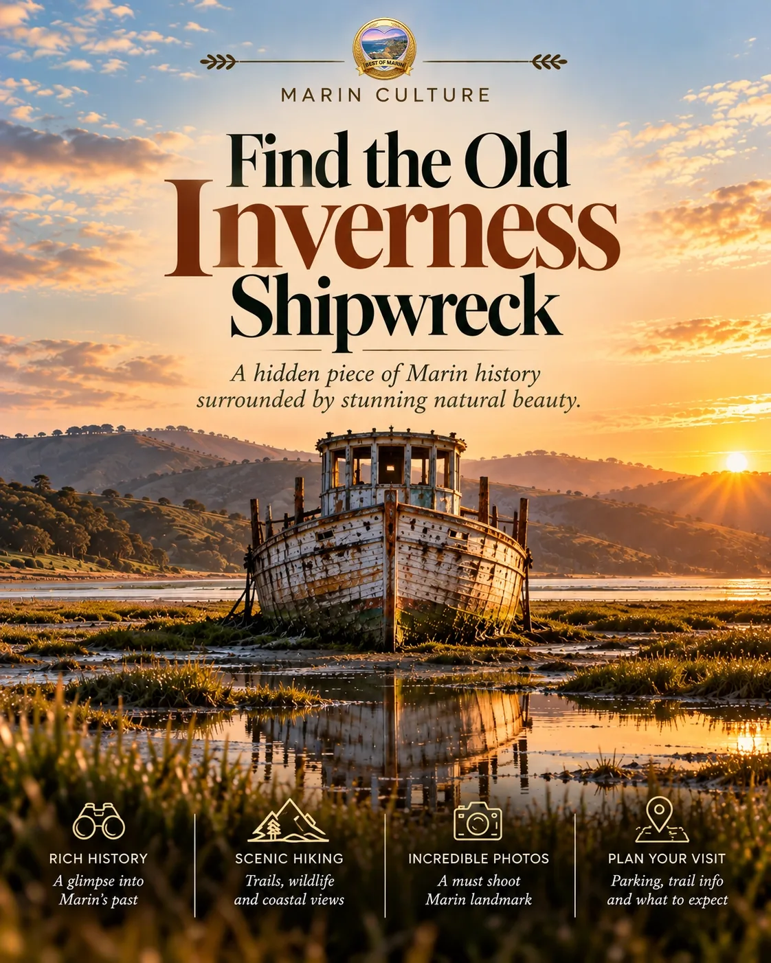
Find the Old
Inverness Shipwreck
The Point Reyes boat became one of West Marin’s most recognizable images. Visit for the story and the bay—not a guarantee that the famous silhouette is still waiting for your camera.
By Best of Marin Staff · Sources reviewed
Why this small boat became a big image
Weathered wood, a leaning cabin, and the bay
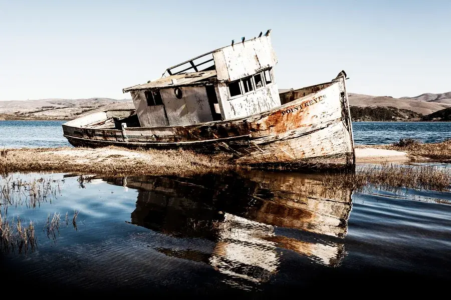
The boat’s appeal was never scale. It was the combination of an ordinary working vessel, an unmistakable lean, and the quiet water behind it. In earlier photographs, peeling paint and reflections turned a modest shoreline scene into something that felt cinematic.
That image traveled much farther than the boat. People arrived in Inverness with a particular composition already in mind: the name on the bow, the tilted cabin, and a reflection underneath. The important thing now is to separate that photographic memory from what you may actually find.
This is a useful stop for anyone interested in how a place changes, not just how it photographs. If the visible remains are disappointing or access is unavailable, the visit has not failed. The bay and the town are still worth noticing on their own terms.
The shipwreck name is a little misleading
According to NPS, the Point Reyes was a fishing boat purchased by an Inverness resident who intended to repair it and intentionally beached it. It is not the historic Point Reyes dairy schooner, and this guide does not present it as the survivor of a dramatic sea disaster.
The same source records serious fire damage in February 2016 and extensive collapse by 2023. The broader lesson is simple: an abandoned wooden vessel is not a preserved museum object. Weather, water, and time keep changing it.
Find the town first, then check permission
Inverness—not the distant headlands
The site is on the Tomales Bay side of downtown Inverness, behind the Inverness Store area off Sir Francis Drake Boulevard. A search for “Point Reyes” alone can send you toward a much larger park area or the lighthouse rather than this small-town shoreline.
Review the location before driving, and save directions if your day takes you beyond reliable phone service. Slow down through town, watch for people crossing, and do not stop in the road when you think you have spotted the right building.
Plan it as a brief detour while already exploring Inverness or the bay. A long dedicated drive for a specific boat photograph is hard to justify when both the condition and access can change.
Public land does not mean every approach is public
NPS explains that the boat is on park land but that the best viewing approach crosses private property. Its FAQ describes permission, dating from May 2016, to view from the east end of the Inverness Store parking lot. That dated statement is not a guarantee of permission today.
Read current signs and ask the business before using its property if access is unclear. Park only where allowed, respect customer-space restrictions, and do not block deliveries or entrances. A purchase does not override a closed area or a no-parking sign.
If permission is denied or the viewing position is unavailable, leave without searching for a route through adjoining parcels. This guide intentionally does not provide a mudflat approach or an alternate trespass route.
Keep your feet away from the wreck
A photo stop is not an invitation to explore inside
NPS explicitly asks visitors not to climb the boat. Follow that advice even if an old image shows someone standing aboard. Broken wood, unstable pieces, and exposed hardware are not a platform for a portrait.
Stay at a permitted, stable viewing position. Do not walk onto marsh vegetation or tidal mud to recreate a reflection shot, and never wade toward the boat. Changing water levels do not turn an unauthorized route into a safe one.
Keep children close, leave debris and fragments untouched, and do not lean on anything associated with the remains. The right photograph is the one available without putting a person or the shoreline at risk.
Tides change the scene, not the rules
Water level can change what a shoreline looks like and how much mud is exposed. It cannot tell you whether access is legal or the ground is firm. Do not plan around a low tide as a way to get closer.
Bring shoes with traction and a layer for bay wind. If rain, poor visibility, standing water, or a closure makes even a brief stop awkward, skip it. In a group, make sure nobody interprets your pause for a picture as permission to move beyond the viewing area.
Photograph what is there, not what used to be
Let the current landscape tell its own story
If a view is available, try a wider frame that includes the water and surrounding landscape instead of chasing a close-up of a missing bow. A photograph of change can be more honest and interesting than an imitation of an old travel image.
Stay clear of business activity and other visitors. Avoid photographing people closely without asking, and keep tripods or bags out of shared space. Do not use fire, sparks, smoke, or other effects around the remains.
If you share an older photograph, say that it is older. If you share a new one, give its date without implying that access or conditions will stay the same. That small bit of context helps the next visitor make a better decision.
Make Inverness the destination, not just the boat
A short stop fits a slower bay day
Allow ten to twenty minutes if parking and permission work out; this is our editorial estimate, not a tour duration. Then give yourself time for a meal, a warm drink, or another suitable stop rather than lingering on private property.
Explore Inverness and our Marin town guide for context. Check business hours before relying on a particular food stop, especially later in the day.
For a longer outdoor outing, consider a Limantour beach walk or elephant-seal viewing at Drakes Beach. Each has its own driving time, weather considerations, and access restrictions; neither is an automatic last-minute substitute.
If there is nothing left to see, keep the story
A map label can outlast the object it describes. If the remains have changed further, been removed, or become inaccessible, accept that rather than trying to prove an old guide right.
The useful part of this visit is learning how an ordinary boat became a local landmark—and why a changing shoreline cannot be frozen in a photograph. You can appreciate that story without reaching the wreck.
Inverness shipwreck questions
Where is the Inverness shipwreck site?
The Point Reyes fishing boat site is on the Tomales Bay side of downtown Inverness, behind the Inverness Store area along Sir Francis Drake Boulevard. It is not at the Point Reyes Lighthouse. Check current permission before crossing private property to view it.
Does it still look like the famous photographs?
Do not expect that. NPS reports that the boat’s sides had largely collapsed by 2023. The supplied interior photograph shows an earlier, more intact state; its capture date is unknown. This guide does not verify the exact condition or continued presence of remains on your visit date.
Was it actually wrecked in a storm?
NPS describes an old fishing boat intentionally beached by an owner who planned to repair it. The popular shipwreck name should not be confused with a documented maritime disaster or the historic Point Reyes dairy schooner.
Can I climb aboard or walk out to it?
No climbing. NPS explicitly warns against it. Stay at a currently permitted viewing position and do not cross mudflats, marsh vegetation, barriers, or private property to reach the remains.
How long should I allow?
Treat it as an optional 10-to-20-minute viewing stop if permission, parking, and conditions allow—not a standalone expedition. That is an editorial estimate. Have another nearby plan if the view or access is unavailable.